Department Water Resources and Drinking Water
How widespread is fluoride contamination of Ghana’s groundwater?
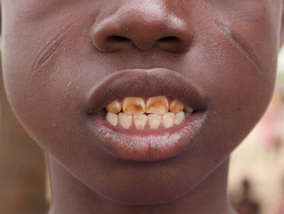
Most people in Ghana have no or only basic access to safely managed water. Especially in rural areas, much of the population relies on groundwater for drinking, which can be contaminated with fluoride and lead to dental fluorosis Fig. 4. Children under the age of two are particularly susceptible to the adverse effects of fluoride and can retain 80–90% of a fluoride dose, compared to 60% in adults. Despite numerous local studies, no spatially continuous picture exists of the fluoride contamination across Ghana, nor is there any estimate of what proportion of the population is potentially exposed to unsafe fluoride levels. Here, we spatially model the probability of fluoride concentrations exceeding 1.0 mg/L in groundwater across Ghana to identify risk areas and estimate the number of children and adults exposed to unsafe fluoride levels in drinking water. We use a set of geospatial predictor variables with random forest modeling and evaluate the model performance through spatial cross-validation. We found that approximately 15% of the area of Ghana, mainly in the northeast, has a high probability of fluoride contamination. The total at-risk population is about 920,000 persons, or 3% of the population, with an estimated 240,000 children (0–9 years) in at-risk areas. In some districts, such as Karaga, Gushiegu, Tamale and Mion, 4 out of 10 children are potentially exposed to fluoride poisoning. Geology and high evapotranspiration are the main drivers of fluoride enrichment in groundwater. Consequently, climate change might put even greater pressure on the area's water resources. Our hazard maps should raise awareness and understanding of geogenic fluoride contamination in Ghana and can advise decision making at local levels to avoid or mitigate fluoride-related risks.
Ghana
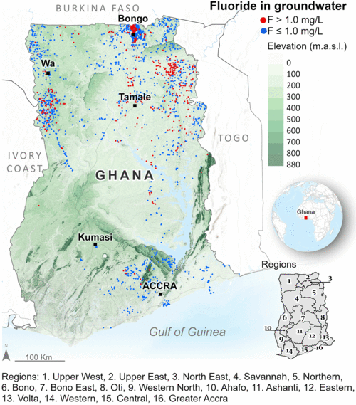
Ghana is located in West Africa at the Gulf of Guinea, between 1°20′ east to 3°25′ west and 4°50′ to 11°18′ north (Fig. 1). Its population reached 31 million inhabitants in 2020. The country has a generally equatorial tropical climate in the south and a semi-arid climate in the north. The south has relatively high and stable temperatures throughout the year, with an average daily temperature ranging from 21–30 °C. The northeast has the most elevated temperatures in the country, reaching 35–40 °C during the hottest months of the year from February to April. Rainfall decreases with increasing latitude, ranging from about 1900 mm per year in the southwest to about 800 mm in the north (Asiamah et al., 1997).
For details, see Araya et al., Water Research, 212, 118083, January 2022
Hazard map
The hazard probability map of groundwater fluoride contamination generated from the final random forest model is presented in Fig. 2. Several regions of high probability are evident across the country. The northeast is the most affected region, with probabilities varying between 50 and 90%. This region extends from Eastern Gonja to the northernmost district of Bongo, excluding a low-probability belt between the districts of Mamprugu Moagduri and Bunkpurugu Yonyo. In the northwest, the Sawla Tuna Kalba and Bole districts have a probability of around 50–70% of groundwater fluoride contamination. And an isolated area in the south near Accra has a probability of around 50–60%. As indicated by the histogram in Fig. 2, 1.2% and 16.5% of the country have a probability >80% and >50%, respectively, of having fluoride in groundwater exceeding 1.0 mg/L.
For details see Araya et al., Water Research, 212, 118083, January 2022
Estimation of the at-risk population
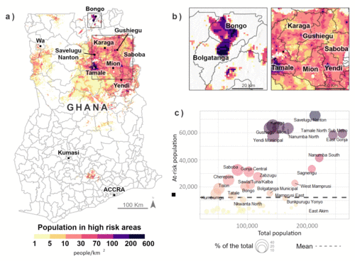
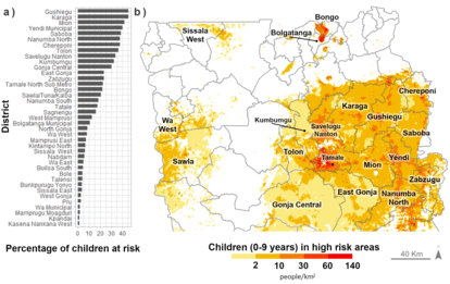
About 15.6% or ∼37,300 km2 of the total land area of Ghana may contain fluoride contamination above the threshold. These areas are mainly in the northeastern part of the country where 24% of Ghana's districts are located. To calculate the number of people potentially affected by high fluoride in drinking water, the population living in these hazard areas was adjusted by the proportion of untreated groundwater use. The total population that has a risk of ingesting high fluoride concentrations in drinking water is around 920,000 (Fig. 3a), or 3% of the population. 3c shows that Karaga, Gushiegu, Yendi, and Savelugu Nanton have the highest populations of potentially exposed individuals, comprising about 42% of those potentially exposed at the district level.
For details see Araya et al., Water Research, 212, 118083, January 2022
Estimation of children at risk
Ghana faces a major challenge in providing drinking water to its most at-risk population, as the northeastern part of the country, which has the highest exposure to fluoride contamination, also contains a greater proportion of the national population of children aged 0–9 years. Districts in the Northern Region have the largest exposed population (Fig. 5), though the exposure varies significantly. In districts such as Gushiegu, Karaga, and Mion, approximately 4 out of 10 children are potentially exposed to levels of fluoride that can affect their health. The Savelugu Nanton district has the largest exposed child population of about 19,000 children, followed by the Karaga district with about 17,000 children.
For details see Araya et al., Water Research, 212, 118083, January 2022
Access our maps
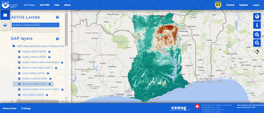
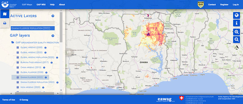
Users can access our maps of fluoride contamination in Ghana and estimates of the affected population through the groundwater assessment platform.
Probability (hazard) map of fluoride exceeding 1.0 mg/L in groundwater of Ghana in groundwater assessment platform
Population of Ghana at risk of high fluoride ingestion through groundwater in groundwater assessment platform
Diffusion
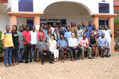
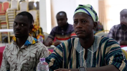
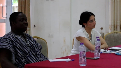
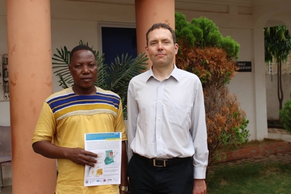
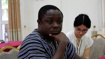
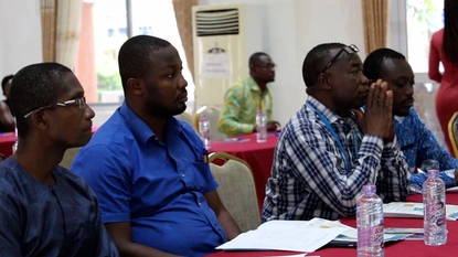
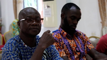
In April 2022, we hosted two seminars in Ghana. One in Accra and one in Tamale, which is the capital of the most affected region. The seminars aimed to communicate the results of this research to relevant stakeholders.

Information sheet
Information Sheet of the publication Fluoride contamination of groundwater resources in Ghana: Country-wide hazard modeling and estimated population at risk, see:
Information Sheet Ghana
Publications
Conferences, seminars and talks
- 04.2022 Dahyann Araya, Joel Podgorski. "Fluoride contamination of groundwater resources in Ghana: Country-wide hazard modeling and estimated population at risk" Seminars, April 2022, Accra and Tamale, Ghana.
- 11.2021 Dahyann Araya, Joel Podgorski, Michael Kumi, Patrick Amankwah Mainoo, Michael Berg. "Geospatial modelling of fluoride contamination in Ghana, considerations on spatial cross-validation and uncertainty assessment" 19th Swiss Geoscience Meeting 2021, November 06-07, Geneva, Switzerland.
- 09.2021 Dahyann Araya, Joel Podgorski, Michael Kumi, Patrick Amankwah Mainoo, Michael Berg. "Modelling fluoride contamination of groundwater in Ghana to estimate the exposed population, with a focus on children." 48th IAH congress 2021, September 06-10, Brussels, Belgium.
About us
Working group of the research article

Dr. Joel Podgorski Senior Scientist Tel. +41 58 765 5760 Send Mail

Dr. Michael Berg Head of DepartmentTel. +41 58 765 5078 Send Mail

Mr. Michael Kumi
CSIR- Water Research Institute, Accra, Ghana

Mr. Patrick Mainoo
CSIR- Water Research Institute, Accra, Ghana
This study was funded by the Swiss Agency for Development and Cooperation within the project “Groundwater Assessment Platform Project”
Contact

Dr. Dahyann Araya Geospatial Modelller Tel. +41 58 765 5621 Send Mail

Dr. Michael Berg Head of DepartmentTel. +41 58 765 5078 Send Mail

